The Wilds of Maoriland
$115.50 NZD • Used
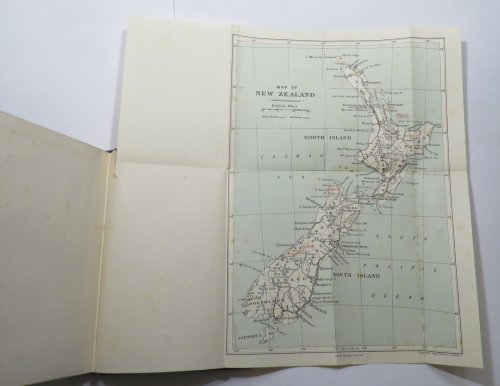
1 folding map "Central Part of the Southern Alps" supplied from another copy, tipped in by the stub. "Map of New Zealand," has a 160mm tear along one fold, with paper tape repair on reverse side.S...
Store: RenaissanceBooks [View Items]
1 folding map "Central Part of the Southern Alps" supplied from another copy, tipped in by the stub. "Map of New Zealand," has a 160mm tear along one fold, with paper tape repair on reverse side.Split to gutter at rear hinge. 12mm tear to cloth at upper margin of rear board. ; xiii, [1], 257, [1 (blank)], [2 (advertisements)] pages + colour frontispiece + 81 illustrations on 49 plate leaves (7 colour) + 2 folding maps at rear (1 supplied from another copy). 6 maps within the paginated leaves (4 full page, 2 small in-text maps). Folding map "Central Part of the Southern Alps" is supplied from another copy. Blue cloth boards with gilt lettering and rule on spine, blue illustration on front board. Page dimensions: 218 x 145mm. [Reference: Bagnall B612 - "Includes chapters on Whangaroa, North Cape, Hauraki Goldfields, Mayor Island, the volcanoes, Urewera country, Karamea and the Southern Alps."]
Product Info
Publisher: Macmillan
Year: 1914
Type: Used
Binding: Hardcover
First Edition
Seller Info
RenaissanceBooks
Address: PO Box 335 Dunedin, Not Required
Website: https://renaissancebooks.co.nz
Country: New Zealand


![The New Zealand Government Gazette for the year 1842. Vol. II, Nos. 1-53. [Complete volume for the year 1842]](/images/stores/2133/24447_4.JPG)
![[Greek letters: Hesuchiou Lexikon] Hesychii Lexicon, Cum Notis Doctorum Virorum Integris, Vel Editis Antehac, Nunc Auctis & Emendatis [. . .] [Two volumes]](/images/stores/2133/26080_3.JPG)
![The Spirit of Laws. Translated from the French of M. de Secondat, Baron de Montesquieu. With Corrections and Additions Communicated by the Author. Vol. I. [Volume I only]](/images/stores/2133/26081_2.JPG)