1862 Johnson's Map Washington and Oregon
$149.00 USD • Used
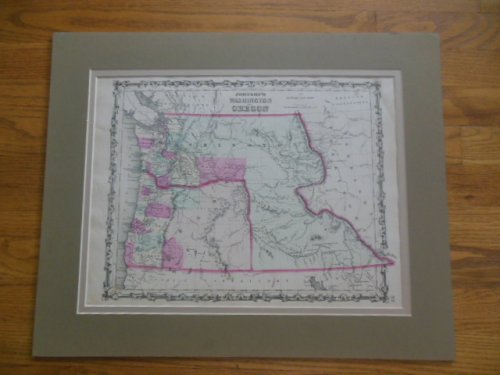
The 1862 map of the territories of Washington and Oregon is a lovely thing with its hand coloring and handsome double face font for lettering. If you look in the lower corner you see the number 57...
Store: GarrisonHouseBooks [View Items]
The 1862 map of the territories of Washington and Oregon is a lovely thing with its hand coloring and handsome double face font for lettering. If you look in the lower corner you see the number 57 which indicates it was the 57th plate in Alvin J. Johnson's New Illustrated Family Atlas published originally by Johnson and Browning in 1862. The question is when was this particular one printed It states on the map that the publisher was Johnston and Ward which means it's around 1863, as that's the year the company's name changed from Jphnson and Browning. The map was made at the start of the Civil War with much land. especially in eastern Oregon. not settled, but you can also pick out sites such as Mt. Ranier and Fremont's Peak among others, plus you can see the route proposal for the Pacific Railroad. The map measures roughly 13" x 17". It's a guess though because it's been professionally double matted and that's all I can see of it. Only faults are a dark spot to upper right corner and a small surface mar to mat at about 3-1/2" down from the top left. There is small thin indentation next to it on the map itself, but the paper is not torn. The map including matting measures 18" x 22". [ SPC ED RM ]
Product Info
Publisher: Johnson and Ward
Year: 1863
Type: Used
Binding: Softcover
Seller Info
GarrisonHouseBooks
Address: 329 Roshon Drive Medina, Ohio
Website: https://www.garrisonhousebooks.com
Country: United States
