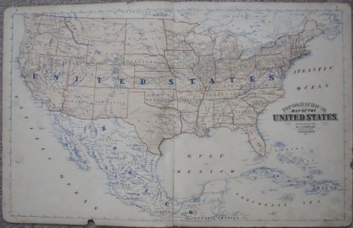
Topographical Map of the United States
$110.00 USD • Used
Large topographical map of the United States. Published in 1873, and likely removed from the 1874 Minnesota Atlas. The verso of the map contains a page with info on "What it Tales to Make a State ...
Store: CrossroadBooks [View Items]
Large topographical map of the United States. Published in 1873, and likely removed from the 1874 Minnesota Atlas. The verso of the map contains a page with info on "What it Tales to Make a State Atlas", and a page on the "Statistical United States Census, 1870". Single folded sheet; sheet size is 27-1/2" x 17-1/2". Some light soil/smudging to the map. Somewhat age-darkened. A few chips in the margins; not affecting the map image. Still, a presentable map. ; 26C
Product Info
Publisher: A. T. Andreas
Year: 1873
Type: Used
Binding: Softcover
Seller Info
CrossroadBooks
Address: W2565 Taylor Creek Road Eau Claire, Wisconsin
Website: https://www.crossroadbookstore.com
Country: United States

![Official Highway Service Map of Wisconsin, 1930 [large]](/images/stores/5137/62818.jpg)


![Masonic Entertainment Committee letter and tickets [Eau Claire, WI] [Postmarked Nov 29, 1933]](/images/stores/5137/64037.jpg)
![Charles Morgan On Retrievers [Signed, Limited edition]](/images/stores/5137/64063.jpg)